Getting Around Downtown Indianapolis Without a Car
Living in downtown Indianapolis without a car is easier than you think. See how walking, the Cultural Trail and the IndyGo Red Line cover daily life in the Mile Square.
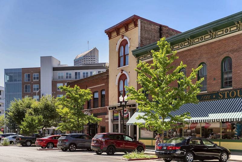
Can You Getting Around Downtown Indianapolis Without a Car?
Yes. For most daily errands, commutes and nights out, living in downtown Indianapolis without a car is realistic, thanks to walkable streets, the Indianapolis Cultural Trail and the IndyGo Red Line. Big shopping trips and airport days take more planning, and this guide shows how to handle both.
Key takeaways
- Live in the Mile Square, the compact downtown core, to keep daily trips walkable.
- Treat the Cultural Trail as your main bike and walking route.
- Ride the Red Line for longer trips across the city.
- Check live arrival times before heading to a station.
- Plan one bigger grocery run and walk for small top-ups.
- Map out the airport days before you travel.
- Keep rideshare as a backup, not a habit.
Can You Live Downtown Indianapolis Without a Car?
Yes, and car-free living in Indianapolis works best as a mix of options rather than one replacement for driving. Walking covers short trips, the trail and bikes handle in-between distances, transit covers longer ones, and rideshare can fill an occasional gap, like a rainy evening. Your building matters too: on-site apartment amenities downtown Indianapolis residents use, such as a gym or pool, can save trips across town.
Cost is part of the decision too. A car downtown means paying for parking, whether that’s a monthly spot, metered street parking or event-day rates. Before you decide, find out how parking is priced where you’d live and compare it with what transit and occasional rides would cost you.
Is Downtown Indianapolis Walkable?
Yes, downtown Indianapolis is walkable for most daily needs. Offices, restaurants, parks and venues sit close together in the core, so many everyday trips can be made on foot instead of by car. The best way to judge walkability is to walk your own routine: home to work, home to coffee, home to the park.
What can you reach on foot?
Many of downtown’s landmarks are close enough to reach on foot, depending on where you start. Monument Circle anchors the core, Mass Ave (Massachusetts Avenue) is known for restaurants and shops, and the Wholesale District is nearby for an evening out. Indiana Avenue, the Canal Walk and White River State Park add green space and waterside paths that make good walking loops.
For a sense of how these landmarks surround one downtown Indianapolis location, a neighborhood map helps.
How does the grid make navigation easy?
Downtown’s street grid makes it easier to find your way. Most streets follow a regular pattern, so once you learn a few main streets, you can orient yourself from most of the core. A few diagonal avenues, including Mass Ave, cut across the grid, so check a map before you walk; a diagonal can replace two legs of a trip with one direct line.
Where Does the Indianapolis Cultural Trail Go? (Map Guide)
The Indianapolis Cultural Trail is a traffic-separated bike and pedestrian path that loops through downtown and links its main cultural districts. It lets you walk, bike or roll between neighborhoods without sharing the road with cars. Because it’s open 24/7, it can serve as your main route for getting around downtown Indianapolis.
Which districts does the trail connect to?
The trail links Mass Ave, Fountain Square, the Wholesale District, Indiana Avenue and IUPUI (now IU Indianapolis), so you can move between dinner, work, class and events on one connected path. For longer rides, it connects to the Monon Trail, which heads north toward Broad Ripple. That extends a downtown loop into a longer car-free route.
How to read the Cultural Trail map and use it for biking or scooters
Reading the trail is easy: look for the tinted pavers that set it apart from the regular sidewalk. For the full route, use the official Indianapolis Cultural Trail map at indyculturaltrail.org.
Plan trips on legs rather than one long ride. Pick the district you’re heading to, find where the trail meets it and hop off there; rejoin anywhere on the way back. If you don’t own a bike, Indiana Pacers Bikeshare lets you ride one leg and walk the next.
The same leg-by-leg approach works on a scooter.
How Does the IndyGo Red Line Work?
The IndyGo Red Line is a bus rapid transit line, which means it uses buses but is designed to run more like rail. Electric buses travel in transit-only lanes and get signal priority at traffic lights, so they spend less time stuck in traffic. That design is meant to make it quicker than a standard bus route.
Where does it go, how do you ride it, and how often does it run?
The Red Line runs about 13 miles, from Broad Ripple through downtown and Fountain Square to the University of Indianapolis. Stations sit about a quarter to half mile apart, so check which one is closest to where you start and where you’re going.
To ride, pay before you board using MyKey+, then get on when the bus arrives. Buses come every 15 to 20 minutes, so check live arrival times before you head to the station.
What About Groceries, Work, and the Airport?
All three are manageable without a car, though each takes some planning. For work, the Red Line passes near many major employers, so a trail-and-transit commute can be a practical alternative to driving.
For groceries, think in two speeds: small top-ups you carry home on foot, and one planned bigger shop each week or two. A sturdy tote or backpack helps, and delivery can cover heavy or bulky items.
Airport days need the most planning. Pack so you can manage your luggage on your own, leave extra time, and line up a backup option in case your first plan falls through.
Which Downtown Locations and Amenities Make Car-Free Living Easiest?
The easiest car-free addresses put daily needs within a short walk and transit close by. When you look at walkable apartments downtown Indianapolis, check how far the building is from the Cultural Trail and the nearest Red Line station, and walk the route to your most frequent stops before you decide.
As one example, our building, Industry Indianapolis, sits at 421 N Pennsylvania St. It’s two blocks from Mass Ave, a six-minute walk from Monument Circle and right on the Cultural Trail. The building includes a concierge, a rooftop pool and a 24/7 fitness center.
The easiest way to know whether car-free living fits you is to try it for an afternoon. Walk a few blocks, ride part of the Cultural Trail and see how far your daily stops really are.
If you’d like to start from our building, you can schedule a tour, and our leasing team will be happy to show you around.
Conclusion
Living in downtown Indianapolis without a car comes down to the right mix. Walk the core, use the Cultural Trail for bike and foot trips between districts, ride the Red Line for longer trips, and keep rideshare as a backup. Add some planning for groceries, commutes and airport days, and choose an address with the trail, transit and daily needs close by.
Frequently asked questions
What is the Mile Square in Indianapolis?
The Mile Square is the roughly one-square-mile core of downtown Indianapolis. Locals use the name as shorthand for the center of the city, so it’s a useful reference when you’re judging how central an address is.
Is it hard to live downtown Indianapolis without a car?
It depends on your routine. It’s easier if you work, study and spend most of your free time downtown or along transit lines, and harder if you commute to the suburbs or leave the city often. Expect a short adjustment period while you learn which trips are easiest on foot, by trail or by bus.
How long is the Indianapolis Cultural Trail?
The Indianapolis Cultural Trail is eight miles long. That’s a manageable distance for an easy weekend ride or a long walk split across a few outings.
Is the Indianapolis Cultural Trail free to use?
Yes. The Cultural Trail is free to walk, run or ride with your own bike. Bikeshare rides are separate and paid through the bikeshare service.
How much does the IndyGo Red Line cost?
A single Red Line fare is $2.75, the price since January 1, 2026. Some riders qualify for half fare, so check IndyGo for eligibility and current pass options.